
The classic Malham Walk is a circular route incorporating Janet’s Foss, Gordale Scar, Malham Cove and Malham Tarn. A fantastic walk taking in a wide range of terrain and beautiful scenery – one of the finest walks in the Yorkshire Dales.
Key Walk Facts: Approximately 6 1/2 miles. 4-hours.
Map of Route: https://www.plotaroute.com/route/581396
You may have seen this walk featured recently on the ITV programme The Top 100 Walks in the UK – this fantastic Malham walk came in at number 3. I was lucky enough to spend a couple of years living at Malham Tarn and did this walk frequently in all weathers. It’s a circular route of just over 6 miles and you should allow 4 hours to give you time to pause and enjoy the many different views. It takes in a wide range of terrain and some lovely scenery from woodland streams, wild flowers and waterfalls to huge mountainous gorges and barren hill tops; it is no wonder it is in the top 3 favourite UK walks.
WALK REPORT
The route involves some climbs, but is not too arduous and anyone who’s reasonably fit will tackle this without any issues at all.
There is plenty of parking in the village, and you start this walk right at the centre of Malham. Standing on the humpback bridge with the Lister Arms behind you, take the path down the left hand side of the beck, and follow the beck as it passes through a couple of fields. In Malhamdale there is a good chance that there will be sheep grazing in some of the fields so keep your eyes open and put your dog on a lead if necessary.
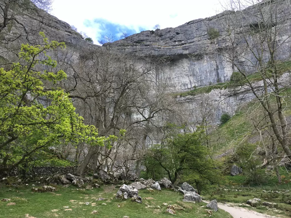
The path continues to follow the beck and takes a turn to the left past an ancient barn known as Mires Barn, and eventually enters a fairy glen-like woodland, through which the stream continues.
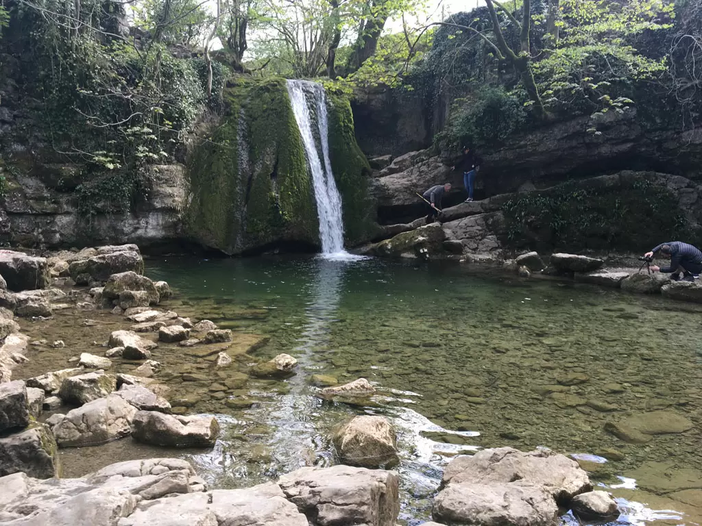
Look out for the fallen tree encrusted with coins! Shortly after this tree you will see the beautiful waterfall known as Janet’s Foss. Foss is an old Norse word for force, an alternative name for waterfall particularly in this part of the world.
Follow the path up to the left and turn right onto the road, and keep on the road for a short distance until you come to a gate on the left which is also the entrance to a campsite.
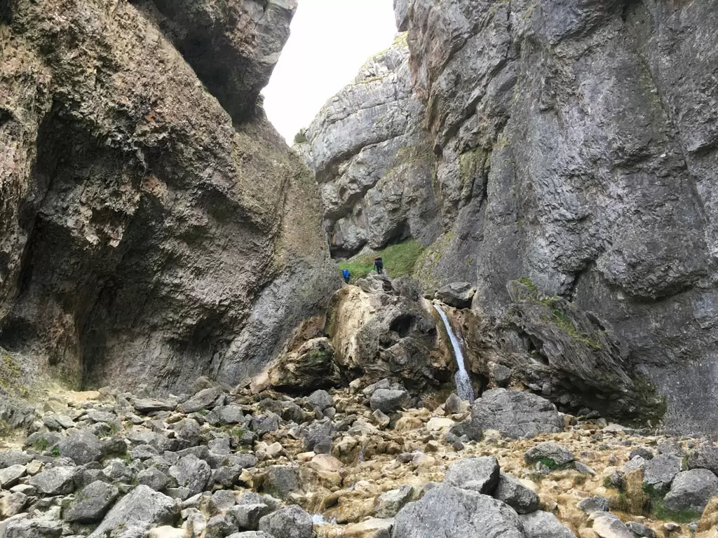
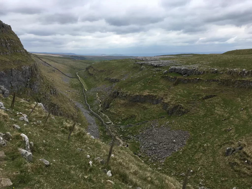
Take the path and keep going toward the huge gorge that lies in front of you. As you turn the last corner you will be confronted by the spectacular Gordale Scar.
After heavy rain the water can come down these rocks in a torrent, but usually it’s more gently flowing and if you’re fairly confident scrambling rocks, it’s a short and interesting climb up the waterfall to rejoin the path at the top! Good boots are needed to keep your feet dry.
If you really don’t fancy this short climb, you can head back and just after Janet’s Foss there is another path that cuts up to the lane to the tops.
We’re going to assume you’ve gone for it and are now at the top of the waterfall, the route of the path is now clear again and you’ve got a bit more of a climb through the gorge, until eventually you appear at the top on some limestone pavement.
Keep following the path, and it ultimately ends at a stile over a dry-stone wall by the road (this is the road that you’ll have followed if you decided against the waterfall climb.)
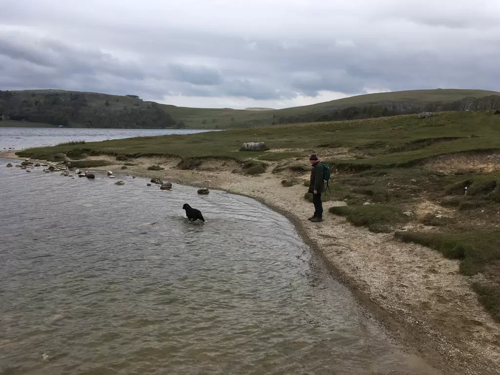
Follow the road for a short distance and it turns left. There is a track going straight on, this forms part of the Pennine Way and takes you to the Malham Tarn Field Centre. However, we are following the road and after about ¼ of a mile there’s a car park on the banks of the Tarn, which is a wonderful place to stop for your sandwiches. And usually there’s an ice cream van here too!
Near the car park on the other side of the road you will see a footpath sign posted to Watersinks, this is where the stream coming out of Malham Tarn disappears underground and is not seen again until you’re at the foot of Malham Cove.
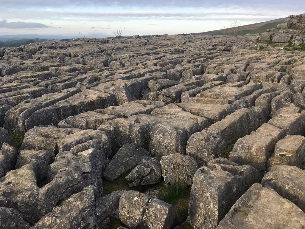
Take this path and follow it through the small valley, and shortly you’ll enter the stunning Watlow’s Dry Valley, which curves through the limestone cliffs and then drops into a U- shaped valley. Keep on this path and suddenly the huge limestone pavement at the top of
Malham Cove appears before. This has been used in Harry Potter scenes, so you may recognise it.
Make you way carefully across the pavement towards the right and you’ll see a stile, climb over the stile and descend the hundreds of steps which take you to the bottom, and think how glad you are that the route goes this way and not in reverse! The path leads away from the Cove and through a couple of fields and then rejoins the road which after ¼ of a mile takes you back to the humpbacked bridge where you started.
Ready for refreshment no doubt, there are several cafes and pubs in the village, which all do lovely food. The Lister Arms, where I worked 25 years ago, is super dog friendly and even has a pile of dog beds for your best friend to relax in after his walk, while you tuck into some well-earned food and a beer!
Roger Westwood, April 2018
If you would like to buy any natural treats or accessories for your walk then visit www.healthfulpets.co.uk


